 微物联研究院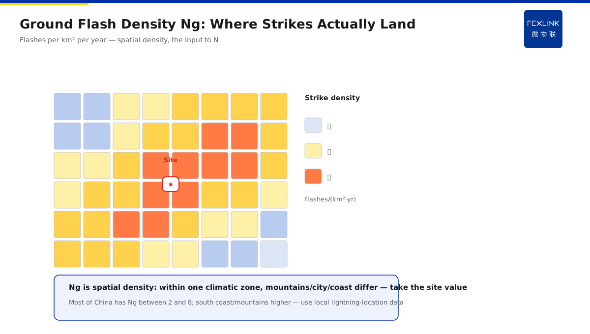
Direct Answer
When you get a project location, how do you quantify how much lightning there really is and at what protection level the design should be? The answer: thunderstorm days (Td, days per year with audible thunder) is the coarsest climatic indicator; ground flash density (Ng, flashes per square kilometre per year) is closer to actual lightning strikes; the estimated annual strike count N is calculated from the building's equivalent capture area times Ng and is the direct basis under GB 50057 for determining the lightning-protection category — design should start from N, not from a feeling that "it thunders a lot here."
A park planned two buildings: one in the city centre, one on a mountain ridge outside the city. Judged only by the thunderstorm days Td, both fall in the same climatic zone and would get the same category. But calculated by ground flash density Ng, the ridge building stands above its surroundings and has a larger capture area, so its estimated annual strike count N is clearly higher than the city building, leading to different protection categories and investment. The key distinction: Td is a climatic impression of "whether thunder happens," Ng is the spatial density of "where strikes land," and N is a direct calculation of "how many times per year this building may be hit" — each step gets closer to the actual project.
Why:
- Thunderstorm days Td: days per year with audible thunder — measures whether the climate is thunderstorm-prone;
- Ground flash density Ng: ground flashes per square kilometre per year — measures where strikes actually land;
- Estimated annual strike count N: equivalent capture area × Ng, directly mapping to the protection category;
- Use order: first check Td/Ng to understand the environment, then determine the category by N and design accordingly.
Key insight: "Td is the climatic impression, Ng is the spatial density, N is the engineering basis — each level gets closer to your building." The design document cites N, not a feeling.
A design institute once classified an ordinary factory building as Category II based on "the area has frequent thunderstorms," overspending on air-termination and SPDs. On review, N was calculated (Ng = 2.98, small capture area) and fell below the Category II threshold — it should have been Category III. After adjustment, investment decreased while remaining compliant. Lesson: the lightning-protection category is decided by N, not by the feeling that "it thunders a lot."
1. Thunderstorm Days Td: The Coarsest Climatic Indicator
Step one: what Td actually says.
Definition:
- Days per year with audible thunder (meteorological observation);
- Reflects the frequency of thunderstorm activity in a region;
- Unit: days/year;
- Counts only days with thunder, without distinguishing where it strikes.
Limitations:
- Hearing thunder does not mean lightning strikes this area;
- It does not reflect the spatial distribution (density) of strikes;
- Under the same Td, city and mountain regions differ greatly;
- Suitable only as a coarse climatic reference.
Usage scenarios:
- Regional climate assessment (comparing thunderstorm activity);
- Rough values when data is scarce;
- Used together with Ng/N (not a substitute);
- Note the statistical year of the Td data.
Key insight: "Td is a climatic indicator measuring how much thunderstorm activity there is, not where strikes land." Td alone is not enough for engineering judgment.
2. Ground Flash Density Ng: Closer to Real Strikes
Step two: what Ng adds beyond Td.
Definition:
- Ground flashes per square kilometre per year;
- Unit: flashes/(km²·year);
- Compiled from lightning-location systems / meteorological networks;
- Reflects the spatial density of ground strikes.
Typical value range:
- Most of China's territory has Ng between 2 and 8;
- Low-flash areas have lower Ng (e.g., some inland basins);
- High-flash areas have higher Ng (e.g., south China coast, mountains);
- Always use the local meteorological data.
Why it is more accurate:
- Distinguishes whether lightning reaches the ground (ground flash vs cloud flash);
- Provides spatial density (can be overlaid on the site);
- Is the input parameter for calculating N;
- Combined with building height and surrounding environment.
Key insight: "Ng is the spatial density — how many times per square kilometre per year, feeding directly into N." Take Ng at the project site, not a province-wide average.
3. Estimated Annual Strike Count N: The Direct Engineering Basis
Step three: how N is composed and used.
Formula composition:
- N = equivalent capture area × ground flash density Ng × correction factor;
- Equivalent capture area: the range extended outward from the building outline (height-related);
- Correction factor: surrounding environment, building importance, etc.;
- Unit: strikes/year.
Height-related:
- The higher the building, the larger the equivalent capture area;
- Protrusions (towers, chimneys) enlarge the capture area;
- Taller neighbouring buildings "shield" the capture area;
- Isolated tall structures have noticeably higher N.
Determining the protection category:
- GB 50057 determines the category (I/II/III) by N and building importance;
- Larger N → higher category → stricter protection requirements;
- Explosion-hazard environments and dense occupancy modify the category;
- N is the basis that must be written into the design document.
Key insight: "N = capture area × Ng, directly determining the protection category — design starts from N, not from feeling." Both capture area and Ng come from verifiable data; N can be recalculated and audited.
4. How the Three Numbers Work Together
Step four: what to look up first and what to calculate next.
Use order:
- Step 1: look up the project-site Ng (lightning-location data);
- Step 2: calculate the equivalent capture area from size and height;
- Step 3: calculate N (including correction factors);
- Step 4: determine the category by N and building nature;
- Step 5: design air-termination, down-conductors, earthing, and SPDs by category.
Data sources:
- Ng: local meteorological departments, lightning-location statistics;
- Td: meteorological observation records (climatic reference);
- Capture area: calculated per GB 50057 formulas;
- Correction factors: per code values.
Common calibration differences:
- Multi-year average vs single-year Ng differ; use the multi-year average for stability;
- Capture-area calculation depends on building shape (not simply the footprint);
- Correction factors depend on the environment (surrounding buildings/terrain);
- State the data year and source in the report for traceability.
Key insight: "Td looks at climate, Ng at density, N at engineering — the order cannot be skipped, and data sources must be stated." Together the three form a complete lightning-environment assessment.
5. Why N Directly Determines the Protection Category
Step five: what the category really means.
Category and protection intensity:
- Category I: extreme risk such as explosion hazards — air-termination + back-flashover protection + strict bonding;
- Category II: important public/dense-occupancy buildings — standard protection;
- Category III: ordinary buildings — basic protection;
- The higher the category, the denser the air-termination network, shorter down-conductor spacing, and stricter earthing requirements.
N thresholds:
- The code gives critical N values (combined with building importance) for the category;
- When N slightly exceeds a threshold, use the actual value;
- Key buildings may be upgraded even with small N (importance correction);
- Once the category is set, design parameters (e.g., rolling-sphere radius) follow.
Impact on investment:
- One category difference can change air-termination and earthing investment by several times;
- Over-rating wastes investment; under-rating exposes risk;
- N is recalculable — the basis for review and audit;
- Recalculate N after renovation/expansion (parameters change).
Key insight: "N is the calculation basis of the category, and the category decides protection intensity and investment — with N clear, the design has its foundation." Checking N is the first step of any lightning-protection review.
6. Product Implementation: Intelligent Lightning-Protection Online Monitoring
WeiWuLian products bring lightning-environment assessment into operational monitoring:
- FL Lightning-Current Monitor: records actual strike events (amplitude/count/path) for comparison with the Ng estimate;
- Monitoring platform: site strike-frequency statistics that verify design assumptions;
- Combined use: design sets the category by N; operation records the facts with FL;
- Continuous improvement: accumulated measured data supports future retrofit assessment.
The design principle in one sentence: "Design uses N to set the category; operation uses FL to record the facts — assessment and reality verify each other." Protection levels have a basis; operating status has data.
7. Common Misjudgments
- Setting the category by "it thunders a lot": looking only at the Td impression. Result: wrong category, wasted investment or insufficient protection. Correct: determine the category by calculating N.
- Using a province-wide average Ng: not taking the project-site data. Result: mountain-plain differences are flattened. Correct: use the site lightning-location data.
- Using the footprint as the capture area: ignoring the height expansion. Result: N underestimated for tall/protruding buildings. Correct: calculate the equivalent capture area per code.
- Calculating N only once: not recalculating after renovation/expansion. Result: the category becomes invalid. Correct: recalculate and review when parameters change.
- Design and operation disconnected: not recording actual strikes. Result: design assumptions cannot be verified. Correct: compare FL measured records with the N estimate.
Scope and Limitations
This article explains the meaning, calibration differences, and use order of thunderstorm days Td, ground flash density Ng, and estimated annual strike count N, applicable to lightning-environment assessment and preliminary category judgment in early-stage lightning-protection design. The precise calculation of N and category determination must follow GB 50057-2010, including the equivalent capture area formula, correction factors, and building-importance classification, completed by professional design with project-site meteorological data. All cases are anonymized (a park, a design institute, a factory building) and do not refer to any specific customer.